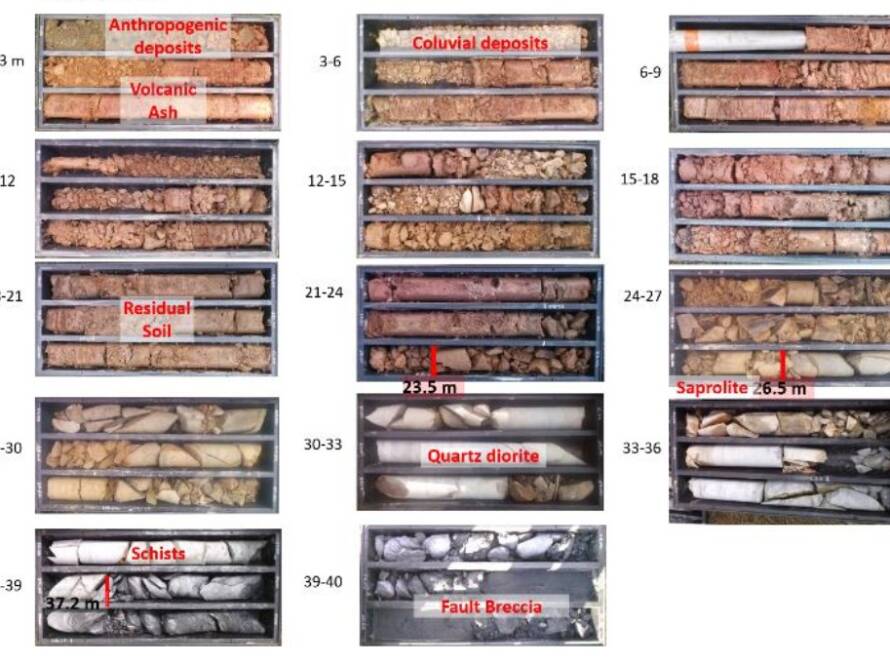
A major landslide in 2019 on a terrace flank in Colombia’s Western Cordillera blocked a key road for months and impacted a recently completed tunnel located 60 m deep and 40 m horizontally from the slope face. Over 120,000 m³ of material were removed to reopen the road. This study presents a geophysical investigation to support stability and hydrogeological analysis. Methods included Down Hole and SPAC seismic testing, vertical electrical soundings (VES), electrical resistivity tomography (ERT), and ambient vibration measurements. Results revealed stiffness profiles, fundamental vibration periods, groundwater presence, stiffness degradation near the tunnel and landslide, and a fault-related damage zone in the bedrock. Geophysical data were validated against boreholes and exposed stratigraphy. High stiffness was found in intact soils, with notable reduction near disturbed areas. Resistivity and VES confirmed a high water table and anomalies near the tunnel. One fault trace showed a resistivity anomaly consistent with water-saturated damage, while another did not. These findings contributed to the geotechnical model and assessment of landslide and tunnel effects.